GeoLibre plugin
GeoLibre is a free, open-source, lightweight GIS that runs in the browser, on the desktop, and in Jupyter notebooks. The Open Climate Service plugin connects GeoLibre to a running OCS instance: it browses the instance's STAC catalog and renders its published GeoZarr datasets on an interactive map — taking the CRS, time axis, variable, colormap, and value range straight from the dataset's metadata, so nothing has to be entered by hand.
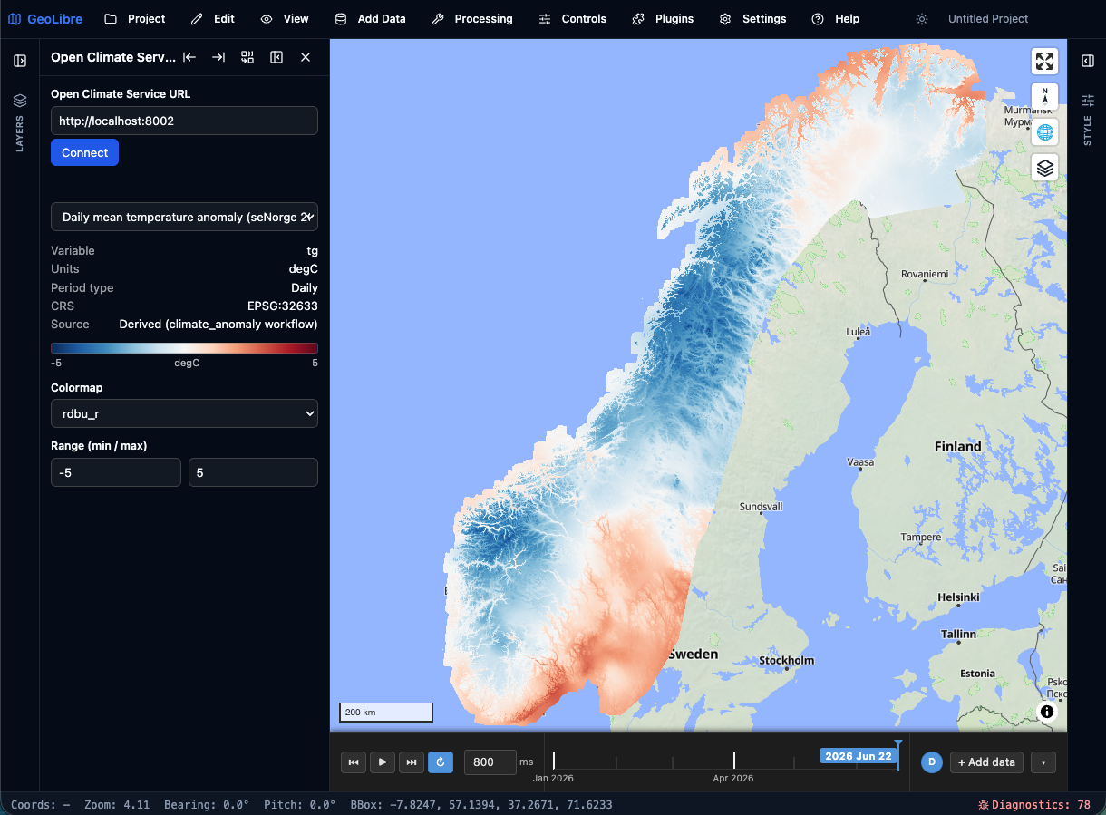
It's a good way to explore an instance's data interactively without writing any code — pick a dataset, step through time, and click the map to read values.
What you can do
- Browse any OCS instance's published datasets.
- Render a dataset on the map with its own default styling — projected national grids (e.g. seNorge on
EPSG:32633) land in the right place automatically. - Step through time with GeoLibre's time slider, at the dataset's own period type.
- Read values by clicking the map (click-to-value).
Install
Two options:
- From the GeoLibre plugin marketplace — in GeoLibre go to Settings → Manage Plugins, find Open Climate Service, and install it.
- From a downloaded zip — grab the latest
open-climate-service-<version>.zipfrom the plugin's Releases page, then in GeoLibre go to Settings → Manage Plugins → Install from file and select the zip.
Use
- Activate Open Climate Service from GeoLibre's Plugins menu.
- In the panel, enter your OCS instance URL (e.g.
http://localhost:8002) and click Connect — the map frames the instance's region. - Pick a dataset to draw it as a layer.
- Step through periods with the time slider at the bottom of the map, adjust the colormap and value range in the panel, and click the map to read the value at a point.
Notes
- The plugin needs a running Open Climate Service instance to connect to; it depends only on OCS's public HTTP contract (
/stacand/zarr/{id}/), so it works against any instance. - Serving a browser build of GeoLibre from a different origin than the OCS instance needs CORS headers on the OCS
/zarr/and/stacrouters; the desktop app fetches cross-origin without that.
Links
- Plugin repository: https://github.com/dhis2/open-climate-service-geolibre-plugin
- GeoLibre: https://geolibre.app/